Post by Henry and Loretta
On our journey so far this year, we rarely have a plan. We've made very few reservations and I tell everyone that mostly we just have a 'general idea' of what lies ahead for us and it's worked out great.
After leaving Moab, our 'general idea' for heading south for the winter, gave us the chance to meet up with some friends in southeastern Utah. This is an area I didn't do much research on and had originally thought we'd just pass through. We spent five (5) nights at the Sand Island Campground on the San Juan River. This was another scenic BLM (Bureau of Land Management) campground with no hookups outside the small town of Bluff, Utah.
We had a day or so before our friends arrived, so we drove out to see some nearby sights.
We stopped at Goosenecks State Park, which is little more than a scenic overlook, but what a view! Here the San Juan River forms tight switchbacks far below that is an amazing sight!
 |
| One of the Goosenecks |
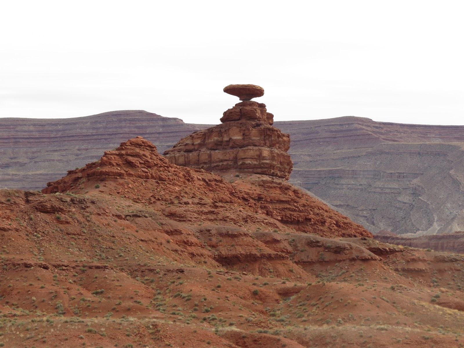
We passed through the town of Mexican Hat and saw the Mexican hat rock formation for which the town is named.
 |
| Mexican Hat Rock |
We drove through Monument Valley - that was quite beautiful and looked a bit familiar only because it's been the filming location of countless western movies.
 |
| Monument Valley on a Cloudy Day |
Our next three (3) days, we spent with Eric and Laurel, whom we met a couple of years ago in Florida. They've been fulltime RVing for several years and their website ravenandchickadee.com has been a great source of both information and inspiration. Check them out
HERE
 |
Eric and Laurel
of
Ravenandchickadee.com |
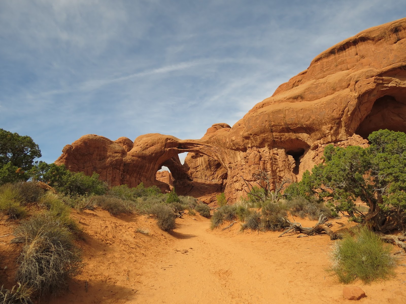
As I mentioned, I didn't do much research on the area, but Eric and Laurel had been there before, and had hikes they wanted to do out to some ancient ruins and Petroglyph sites.
Now, these hikes weren't like a lot of hikes we do, with a signed parking area at the trailhead and nicely maintained trails.
 |
| Laurel Leading the Way |
Oh, no! These hikes came from information on the internet that just give you a 'general idea' of how to find these ancient sites. Apparently, the Southwest US has countless places like this that take some research and effort to find.
Our first day turned into quite an experience! We were headed to the Procession Panel Petroglyphs, and unknowingly, had parked about a quarter mile before the true trail head. We started by hiking through some oozing mud that turned our shoes into big gobs of goo.
 |
| Introduction to Canyon Hiking |
Then we followed some rock cairns that should have lead us to the panel, but instead, we ended up on the opposite side of a huge wash from where we needed to be. (A wash is a dry bed of an intermittent stream at the bottom of a canyon, typically dry, but subject to rapid flow during flash flooding). Spotting another couple in the far distance, headed up the
other side of the wash helped us realize we were on the wrong path, or we might not have ever found it. Of course, now we had to hike back down into the canyon and then up the other side.
 |
| Going Back Down the Canyon |
We eventually ran into the other couple on their way out and they gave us a 'general idea' of how to get back out to the correct parking area.
Anyway, we DID find the Procession Panel Petroglyphs and it was very cool! To me, these were as good as the petroglyphs we saw earlier in the year at the Petroglyph National Monument in New Mexico, but here, they were pretty much in the middle of nowhere for anyone to find with some effort. Or a LOT of effort.
 |
| Proof! We Made it to Procession Panel Petroglyphs |
 |
| Procession Panel Petroglyphs |
I'd like to say our hike out went smoother, but it didn't. We thought we'd follow some other rock cairns and they would lead us up the road a bit from where we parked. Nope! The cairns ran out at a field of sticker bushes that involved painful hiking to get through. We followed this up with a steep descent into an overgrown wash (also known as sliding on your butt), that we had to navigate and then up (climbing, crawling, and digging) the steep other side.
 |
| About to do the Slide |
The ride home was filled with jokes about 'never going to hike with each other again', but it was all in fun.
Mostly.
The next day, they took it a lot easier on us.
First, we hiked out to some ruins that were in amazingly good shape. The ruins were reminiscent of what we saw at Mesa Verde, but on a much smaller scale.
 |
| Ancient Rock Structures |
This site also included pictograms, some of which were merely hand prints. To think of WHOSE hands they were, how long ago they were made. and now here we were, intently studying them, is just unreal. There were small shards of pottery scattered about and even partial corn cobs that could be hundreds of years old!
 |
| Pictographs of Indian Hand Prints |
 |
| Amazing! Mostly Intact Corn Cobs and Grinding Stone |
We followed this up with a much shorter hike to the Wolfman Petroglyph Panel. These may have been the best petroglyphs we've ever seen. We all commented they must have been made by THE artist of the people living here at the time.
 |
| Wolfman Petroglyph Panel |
 |
| Wolfman Petroglyph Panel |
We topped off the day with a scenic drive through the Valley of the Gods, which turned out to be even more impressive than Monument Valley, in our opinion.
 |
| Valley of the Gods |
 |
| Valley of the Gods |
Day three (3) was to be a hike out to ruins that Eric and Laurel had done a few years earlier, called House on Fire. If you photograph this site at just the right time of day, the sun shining on the rocks make the ruins look like they are on fire in the picture.
Today's hike was Laurel, Loretta and I, as Eric stayed behind to catch up on some work.
We made the hour drive armed with more 'general idea' directions, and arrived at the trail head. Or so we thought.
Laurel had told us it would be a fairly easy three (3) mile round trip hike out to the House on Fire location. All we had to do is 'follow the wash'.
Long story short:
We followed the wrong wash.
This time, we parked about a quarter of a mile
past where we should have. The hike turned into a six (6) mile round trip hike, which included scaling a steep incline at the halfway point to some ruins, where
someone declared, "This isn't House on Fire!".
 |
| NOT House on Fire |
Awesome.
I can't say we were too disappointed, because we did come across several different ruin sites along the hike. And again, to me, these were about as cool as Mesa Verde because we had them all to ourselves.
 |
| Another Set of Ruins |
We did spend the rest of the day joking about 'never wanting to hike together again'.
All in fun.
Mostly.
That pretty much sums up our three adventurous days with Raven and Chickadee.
Sometimes our 'general idea' for traveling is influenced by the weather forecast, and the current forecast called for us to head further south to avoid possible snowy conditions.
In all seriousness, we would have liked to spend more time with Eric and Laurel, because we truly had a lot of fun. Our winter destinations are on opposite sides of the country, but we are planning on catching up with them again next summer in Washington, where they know ALL the good places to visit and hike.....
Mostly.